|
|
|
|
|
|
![]()
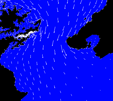
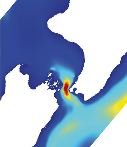
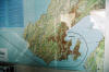
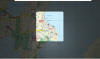
"Modelled hot spots for tidal energy in Cook Strait. Currents in these areas can reach several metres per second. (Map: Rym Msadek)"Source
|
|
|


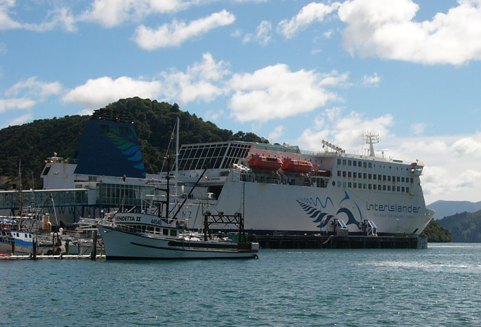
| Kaitaki | ||
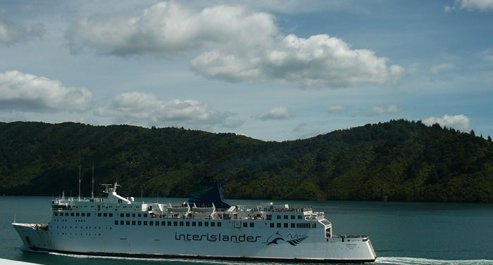
| On March 2, I made the crossing of Cook Strait on the Interislander boat, marketed under the name Kaitaki, which is Maori for 'Challenger'. The ship's name is Stena Challenger. Wikipedia Entry here. | ||
|
|
||
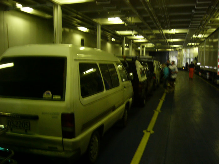
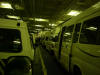
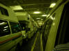
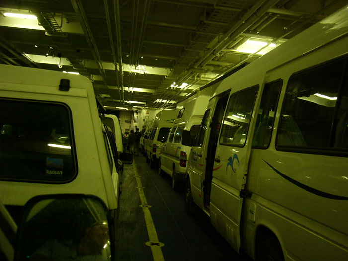
| Took a picture of the van once I got on board. Ok, not the best shot, but if I used flash, then only the foreground of the shot would be visible. Another column of vehicles would come in where the people are standing. Interislander was quite smart, as they put all the wide vehicles (campervans) next to a column of narrow vehicles. You'll see what I mean in the images further down. | ||
|
|
||
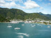
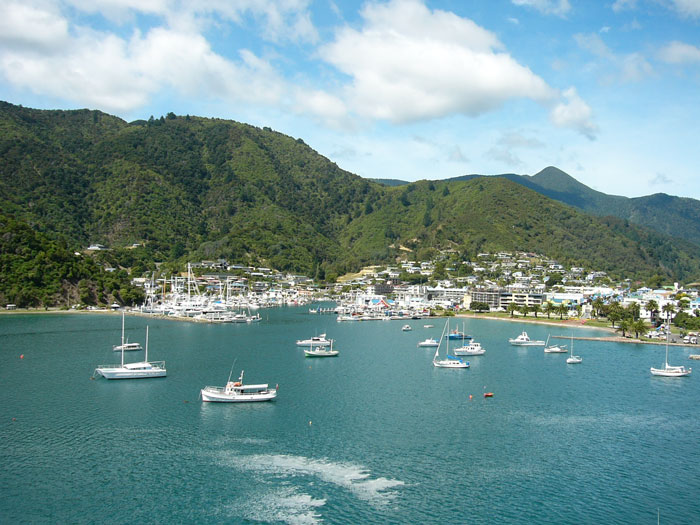
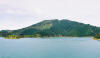
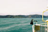
| Picton, from the stern sundeck. | ||
|
||
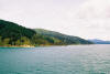
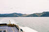
| The ship leaves Picton and goes through the protected waters of the Queen Charlotte Sound, before crossing the Cook Strait. | ||
| The names "North Island" and "South Island" lead to the common misconception that the crossing of the Cook Strait is a south-to-north journey. In reality, it more of a west-to-east crossing. Picton is almost due west of Wellington. Most of Golden Bay, the top part of the South Island, is actually north of Wellington. | ||
|
||
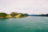
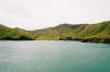
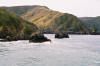
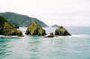
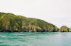
| Some representative images of Queen Charlotte Sound. Most of the first hour of the trip is spent crossing the Sound. The next 30 minutes or so are to traverse the Tory Channel. | ||
|
||
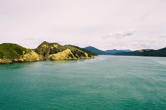
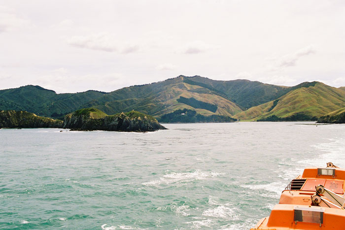
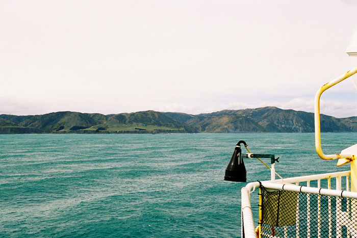
| Rounding the bend to leave the Tory Channel and enter the Strait. | ||
|
||
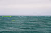
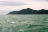
| Goodbye South Island! | ||
|
||
| When I move on from a place, I try not to frame the matter as a departure. Now that I've been there once, it's much easier to go back and visit again. I tell myself that the things that I like, I'll probably revisit, and the return trip will be better because I can go back to the good parts. | ||
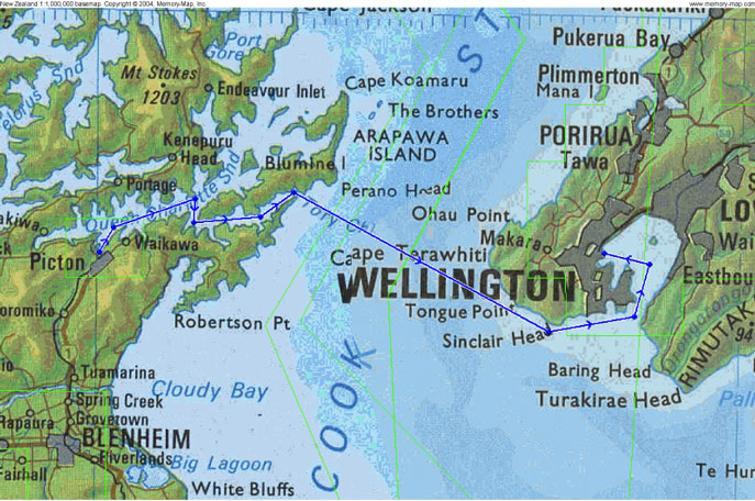
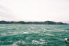
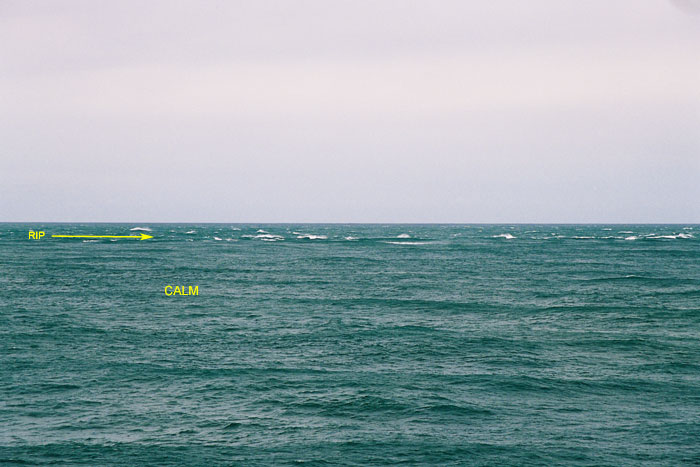
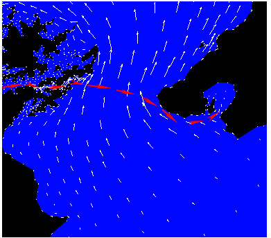
| Then the fun part started. Midway through the strait is an interesting occurrence, the Karori Rip. It is a long narrow area of chop bordered by areas of relative calm. It runs roughly perpendicular to the shore of the North Island. It is caused by the intersection of two currents. Usually in the ocean, a sharp change in surface conditions is accompanied by a change in wind patterns. In this case, the wind is consistent, yet there is this isolated area of chop. | ||
|
||
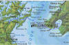
| The National Institute of Water and Atmospheric Research has an good animation presenting the tidal current movements in Cook Strait. | ||
|
|
||
|
|
|
|
| The ferry's course across the Strait is almost a direct horizontal line across this graphic. | ||
| NIWA has also studied using the tidal currents in the Strait as a source of power generation. | ||
|
|
||
|
"Modelled hot spots for tidal energy in Cook Strait. Currents in these areas can reach several metres per second. (Map: Rym Msadek)"Source |
||
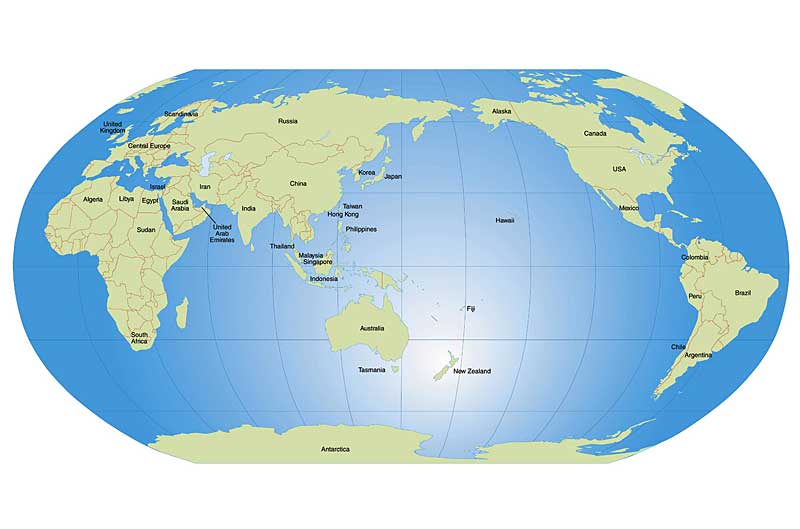
| That's just the tidal currents, which are but a drop in the bucket. New Zealand is located right smack in the middle of the Roaring Forties, which are wind and ocean currents that circumnavigate the globe from west to east. If you look at a map of the world, | ||
|
|
||
| you can see that the nearest land mass at that latitude is South America. Almost all of the South Island is lower than Australia. When this current hits the South Island, it splits. | ||
|
|
||
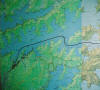
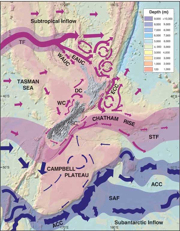
| Some of the current runs northward along the west coast, to form the Westland Surface Current ('WC'). Near the top of the South Island, the westerly Tasman Flow also becomes prominent. There's one opening for these currents, The Cook Strait. This current running through the Strait is called the D'Urville Current, ('DC') named for the French explorer who discovered the strait when his ship was blown into it. But, there's also the Southland Current ('SC'), which loops around Otago and runs straight north, towards the Chatham Rise. Some of this current enters the strait, and collides with the D'Urville Current, a little bit south of the course of the Ferry. | ||
| The Lowry Bay Yacht Club advises, "The combination of broken water and strong wind gusts between Sinclair Head and Cape Terawhiti make it advisable to transit this section of the passage (commonly known as The Rip) at slack water. This section of your voyage is generally the most uncomfortable and should not be attempted by small craft or the inexperienced except in favourable conditions. Strong southerly winds with a SE setting tidal stream can make this area a real horror show, and in the interests of safe boating and harmonious crew relations, should be avoided." | ||
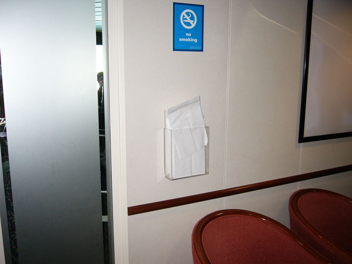
| There are magazine racks all over the boat. Some are made of wood with trim, nicer than this practical lexan thing. But, instead of magazines, they're filled with barf bags. That boat had barf bags EVERYWHERE. | ||
|
|
||
| The very next day, the Aratere got caught in a storm, and took eight hours to make the crossing. It was hit by a 10 metre wave. The boat heeled over 45-50° twice, causing rail cars to topple. Wellington Dominion Post article here. Sailors are a superstitious lot, and it's boats like the Aratere that contribute to this trait. | ||
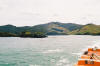
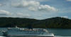
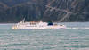
| Two other Interislander boats. The one on the left is perhaps 30 minutes from Picton; that's the north side of Queen Charlotte Sound behind it. The one on the right had left Wellington perhaps an hour earlier; that's the shore of the North Island in the background. | ||
|
||
|
|
||
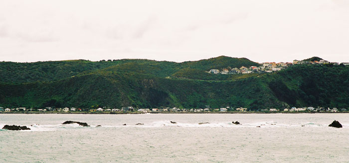
| This is Seatoun, a Wellington suburb that all traffic entering Wellington's natural harbour passes on the west. Apparently Peter Jackson lives there. | ||
|
||
| The Interislander Ferry runs a very efficient operation. I guess it must be, since they run the trip several times a day,365 days a year. Once we arrived in Wellington, they made several announcements that all passengers who had boarded the ship on foot should remain seated in their seats. The purpose of this request was to allow the passengers who had come on board by a vehicle the opportunity to go downstairs to get into their cars. I guess they had traffic jams of the on foot passengers clogging up the lobbies and hallways of the ship, while in the vehicle passengers were still trying to get downstairs. They made the announcements for the vehicle passengers to go downstairs to get back into their cars a good 15 to 20 minutes before we finally arrived at the Wellington dock. I guess they want to make sure that all the vehicle drivers are back in their cars and ready to go. Because, if there's one car that hasn't started, then all the other vehicles behind it won't be able to get off the boat. I took a few pictures, while I was sitting in the van waiting to drive off. | ||
|
||
| Saw this when I was waiting to be released from the boat. The calm of New Zealand is occasionally disrupted by gang bangers. There are some Angels about, but I think most of the activity in NZ is homegrown. | ||
|
|
||
| Interislander's site: | ||
|
|
||
| 060315 | ||
| 060621 | ||